
Widespread showers and thunderstorms across much of the central and eastern U.S. will produce areas of excessive rainfall, especially in the southern Mid-Atlantic states. Scattered severe thunderstorms are expected from Montana into portions of the central/southern Plains this weekend. A heatwave will build in the Desert Southwest, in parts of Arizona, southeastern California, and southern Nevada. Read More >
Last Map Update: Sat, Jun 14, 2025 at 7:36:32 pm PDT


|
Text Product Selector (Selected product opens in current window)
|
|


 Hanford Radar
 Edwards Radar
 Recent Temperatures
 Satellite
 Weather Map
 Central Valley and Sierra Nevada Smoke Forecast
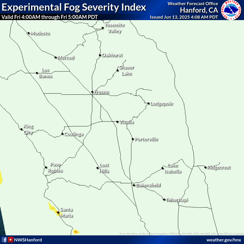 Experimental Fog Severity Index
 Social Media
 Caltrans QuickMap
 Drought